
Mountain exploration began in the Himalaya after the climbing of Mount Blanc in Europe in the eighteenth century created the attitude necessary for the exploration of the great Himalaya range and this coincided with the exploration for the British East Company.
The Company started trading in India in the seventeenth century, it wishes north to Central Asia for the lucrative market to expand their trade, but the high mountains were abstract on their way to cross the legendary cities and their inhabitants were divided into hostile Kingdoms. Through local traders and pilgrims had been crossing the mountains for thousands of years, there were no maps of the area. Most of the information on the mountains was collected by the famous Pundit Indians surveyors especially trained by the Indian's intelligent Army. The Pundits disguised as pilgrims, traders, explored and surveyed much of the Karakorum, Himalaya, and Tibet during the second half of the nineteenth century.
In the wake of Pundits, the European explorers and mappers flourished as hunters or parading in local costume sporting the turbans. They suffered extraordinary hardships exploring the high passes of Himalaya, Karakorum, and Hindukush looking hopefully for possible trade routes and fearfully for lines of invasion opened to the Russians.
Two Jesuit missionaries reached Leh in 1631 and 1715, but it was not until 1808 and Mounstaurt Elphimstones”s mission to Kabul that the first showing the map of the upper Indus River, the Karakorum and Himalaya mountains were drawn by the British.
In 1820 a 55-year-old British explorer and trader did the round form Kulu to Leh and Sirinagar to manage the British East India Company”s sturdy farm and his journey in 1812 had taken him to Tebit.
Later Moorcroft went to Bukhara to buy Turkman horses and was killed there papers were collected by later travelers and published in 1841.

The first man to Karakurum was Godfrey Thomas Vigne in 1835, left Sirinagar(India) in that year passing nothing just an English traveling gentleman for health crossing Burzil pass and Deasai plateau reached to Skardu who was the first foreigner to come here and became a friend to local Raja(king) of Skardu spent four summers by exploring the area right up to the Hispar pass and west and East Mustagh passes quietly assessing the possibility of Russian forces advancing through the Karakorum. The East and West Mustagh pass had been used for trade routes between Baltistan and Yarkhand but both were blocked by advancing ice by the mid-nineteenth century.
The real highest mountains of the Karakorum mountains were not sighted until 1856 seen by Thomas Mountgnmorie of the grand Trigonometrical Survey of India, sanding on peak Pir Panjal spotted two high peaks from a distance of 220km away, which he labeled K1, K2 the K standing for the Karakorum . K1 turned out Mashbrum which was measured by the same 7821 meters, it is still accepted the same today. He was one of the brothers who undertook extraordinary journeys through the Himalaya. His brothers were the first to cross the Karakorum pass, and Adolf was the first European to reach Yarkhand and murdered him near Kashgar. Until 1858, after its sighting has K2 measured 8622 meters from vent age point the Deosai Plateau. The mountain was measured again by Henry Havreshman Godwin Austen in 1860 at 8611 meters which are considered to be the same today.
Godwin Austen descended from the Panmah glacier and attempted the West Mustagh pass, but failed to see the real mountains. He next headed up the Baltoro glacier as for as a place Urdukas and climbed above the camp to a point from which he could see the K2 over the intervening mountains. This was the mountain's first close sighting which established its position in central Asia.
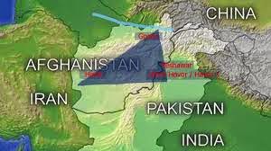
The first European to record his visit to Gilgit(the Central point of Northern Areas) was Dr. Gottlieb Lietner who crossed the Indus in 1866, and march up to Gilgit which was then in the charge of Dogra garrison of the Maharaja of Kashmir. Leitner was an indefatigable Ethnographer and linguistic who spoke twenty languages stayed 36 hours recording local culture and languages. The next visitor to reach Gilgit was George Hayward who spent the winter of 1869, there before moving on to Yasin for the spring. He returned again in the summer of 1870 wit the intention of crossing Darkot Pass in his searching for the source of Oxus but was murdered near Darkot. In 1874, Jhon Biddulph explored the Pamir and the Northside of the Hindukush. He discovered how low and green the Broghil pass, was raising the alarm of how easy it would be safe for the Russians to ride in from the north. In 1876 he became the first western visitor to Hunza and left vivid description the road into the remote kingdom in his Tribes of Hindukoosh.

Francis Younghusband made as to the first European of the high Karakurum pass in 1887, using Mustagh pass and spent two years exploring all of the passes between Hunza and China and between China and Chitral and Afghanistan, thus completing the line of India's defenses against Russian and Chinese attacks. The British Boundry Comission followed in his wake drawing the northern border of the Indian Empire. The outline of the Empire being complete, it remains to fill in the blank on either side of the border of the areas still mark with challenge unexplored on early twentieth century maps. The major valleys in the Central Karakurum were mapped before independence of Pakistan in 1947, and Eric Shipton and Horald Tilman filled in the last great blank when they surveyed the north side of the K2 and snow lake. Yet to this day glaciers radiating from snow lake are not fully mapped similarly, although most of the valleys of Hindukush have been unexplored and waiting anxiously for the explorers.

The first European to record his visit to Gilgit(the Central point of Northern Areas) was Dr. Gottlieb Lietner who crossed the Indus in 1866, and march up to Gilgit which was then in the charge of Dogra garrison of the Maharaja of Kashmir. Leitner was an indefatigable Ethnographer and linguistic who spoke twenty languages stayed 36 hours recording local culture and languages. The next visitor to reach Gilgit was George Hayward who spent the winter of 1869, there before moving on to Yasin for the spring. He returned again in the summer of 1870 wit the intention of crossing Darkot Pass in his searching for the source of Oxus but was murdered near Darkot. In 1874, Jhon Biddulph explored the Pamir and the Northside of the Hindukush. He discovered how low and green the Broghil pass, was raising the alarm of how easy it would be safe for the Russians to ride in from the north. In 1876 he became the first western visitor to Hunza and left vivid description the road into the remote kingdom in his Tribes of Hindukoosh.
For nearly half a mile it was necessary to scramble over rocky ledges, sometimes letting oneself down to the water’s edge, then ascending 300 to 400 feet above the streams holding on corners of the rocks, working along rocky shelves three or four inches wide and four projecting knobs and corners where no four-footed animals less agile than wild goat find a path. Today’s two to three hours easy drive up to the Karakorum Highway is somewhat less adventurous. In1877, Biddulph was made the first British political agent to Gilgit, a lone British officer in what was then the remotest outpost of the British Empire. In 1878, he visited Yasin in the west of Gilgit which was (once the center of little Bolor during Tibetan era) made the first crossing of the Shandur pass, and walked down to Chitral to meet the ruler of the time. The vulnerable Gilgit agency was closed in 1880, after attack by the ruler of Yasin. Biddulph would probably have been killed. The agency did not open until 1889 In 1883 William Mac Nair, disguised as a Muslim doctor became the first western to cross the Lawari pass to Chitral. He visited Kalash valley and saw the Dorah pass, the main trade, and pilgrims route, and used for thousands of years between Central Asia and the sub-continent. He left via Shandur pass to Gilgit going from there to Srinagar In 1885, Colonel William Lockhart a friend of Charles MacGregor and deputy mounted the first British mission to Dardistan taking along 300 mules laden with gifts for the local people. His party explored the yasin Darkot and Broghil and Shandur pass before descending to Chitral town. They managed to visit Drosh, the Dorah pass, and kafiristan, recording all they saw before returning via Gilgit to Srinagar. They complete the first gazette to Chitral. The same year Lockhart and his company struggled up to Hunza. By appeasing the king with promising they secured permission, to continue over the Klik pass into China. They came back round via the old trade route down the Wakhan Corridor and trough Badkhshan inspecting the north side of the Hindukush before returning to Chitral via Dorah pass.

Francis Younghusband made as to the first European of the high Karakurum pass in 1887, using Mustagh pass and spent two years exploring all of the passes between Hunza and China and between China and Chitral and Afghanistan, thus completing the line of India's defenses against Russian and Chinese attacks. The British Boundry Comission followed in his wake drawing the northern border of the Indian Empire. The outline of the Empire being complete, it remains to fill in the blank on either side of the border of the areas still mark with challenge unexplored on early twentieth century maps. The major valleys in the Central Karakurum were mapped before independence of Pakistan in 1947, and Eric Shipton and Horald Tilman filled in the last great blank when they surveyed the north side of the K2 and snow lake. Yet to this day glaciers radiating from snow lake are not fully mapped similarly, although most of the valleys of Hindukush have been unexplored and waiting anxiously for the explorers.


Mountains are natural beauty in the world and this post show clear outlook over northern mountains of Pakistan.
ReplyDelete